Hard10 milesCircular
Cautley Spout and The Calf
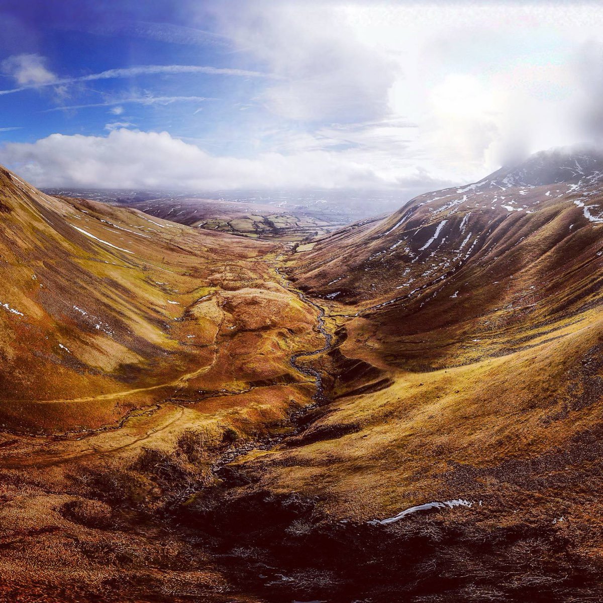
The classic Howgills day: follow the River Rawthey to England's highest above-ground waterfall, climb beside it and top out on The Calf (676 m), the range's highest point.
Where to leave the car for Cautley Spout, how long the walk to the falls takes, what to watch for with dogs and young children, and the 2,000-year history of the valley below England's highest cascade.
There is room for around five cars at Cautley, near the Cross Keys, if everyone parks considerately. It fills up quickly on busy holidays, so arrive early or have a plan B.
Space is tight: around five cars, parked with care so the road and gateways stay clear. On busy holidays it fills quickly. If it's full, don't squeeze onto the verge. Sedbergh is the start of the full walk, so you can always begin from town instead.
We haven't checked bus times for this post. Cautley is about four miles from Sedbergh along the A683, so check current timetables before relying on a bus there or back.
Allow around 40 minutes from the parking to the falls. A new bridge on the way now gives easy access for horses and for the emergency services.
The going is easy at first and gets steeper the closer you get to the falls.
The ground near the falls is slippery underfoot, and it can be dangerous for dogs and young children close to the edge. Keep dogs on a lead and little ones close on the steeper section.
Cautley Spout is fed by a spring higher up, towards the fell summit. The water pours off the edge of the high plateau around The Calf, drops through the falls, and runs on down the valley as Cautley Holme Beck to join the River Rawthey near the Cross Keys.
Cautley Spout is usually described as England's highest cascade waterfall above ground. It isn't one long leap but a chain of falls down a steep gully, and the figure most often given for the whole drop is about 198 m (650 ft). Measurements vary with where you count from: an 1820s Lakes guidebook put the whole cascade at 860 feet. Hardraw Force, over in Wensleydale, has a longer single unbroken drop.
The great bowl of rock beside the falls is Cautley Crag. Geologists describe it as the only well-formed glacial cirque in the Howgills, scooped out by ice in a range that is otherwise famous for its smooth, rounded tops.
On the valley floor below the falls, about three-quarters of a mile up the path from the Cross Keys, low earthworks and scattered stones mark a prehistoric enclosed settlement. It is usually described as Iron Age, which would make it around 2,000 years old: a small farming community growing crops and grazing animals beneath the Spout. It's hard to make out at ground level and much easier to see from above, on the path up to the falls.
A well-made trackway, about 3 m wide, runs west from the settlement up the middle of the valley towards the falls. In places it is a hollow way worn into the ground, in others a built-up causeway. A stone-edged track leads right to the foot of the falls and stops there. Some have wondered whether the waterfall had a special or ritual meaning for the people who lived here, but nobody knows.
Later farmers used the valley too. The ruins of a sheepfold, thought to be medieval, sit over part of the settlement, and surveys of Cautley Crag above have recorded a possible early medieval or later enclosure, a cairn and a shieling: a hut used while animals grazed the high pasture in summer. Historic England's archaeologists surveyed the valley in the 1990s as part of a wider look at the Howgills.
These are archaeological remains in a protected landscape, so look but don't move the stones.
The whitewashed inn by the start of the path is the Cross Keys, a temperance inn: it serves food but no alcohol. It began life as a farmhouse called High Haygarth, the date 1732 is carved on the door lintel (the building is probably older), and it is Grade II listed. It became an inn after the road was moved to run past it in 1819.
It has been a temperance inn since 1902. Local accounts link the change to a drowning in the River Rawthey, though the versions of that story differ. In 1949 it was left to the National Trust, which still owns it, and the gift is said to have come with a condition that alcohol would never be served there again. If you want to bring your own drink with a meal, ask the inn first.
Any time of year, but the view around the winter solstice is amazing. Days are short then, so check sunset times and set off early.
The full round to The Calf is on our Cautley Spout and The Calf page. The climb beside the Spout is steep and stepped, so take care coming down in any weather, and check the forecast for the tops before you set off.
The classic Howgills day: follow the River Rawthey to England's highest above-ground waterfall, climb beside it and top out on The Calf (676 m), the range's highest point.